Third in a series about the Inca Trail
Day Two of the Inca Trail has a reputation as the most grueling day of the trek (though as it turned out, Day Three was plenty grueling in its own way). Unlike the other days of the trek, Day Two doesn’t feature any important ruins, but there is plenty of natural scenery as hikers ascend vertically 1,200 m (3,937 ft) up a valley to the high point of the trail before descending to the second campsite. There was almost no flat terrain during the entire day of hiking: It was all up or down (mostly up!).

We’d gone to bed right after dinner the night before. Fatigue from Day One of the trek made for a mostly restful eight hours of slumber. A couple times during the night I woke up briefly to strange rustling noises outside the tent…maybe those stray dogs that Percy advised us to protect our gear from. At any rate, I wasn’t going out to check! Yaneth delivered our wake up (and tea!) around 5:40 am. The campsite was just a few minutes downhill from the second checkpoint. Unlike the first, the guides just had to give the wardens a roster and our permits; no passport check was required. Around 8 am, we began hiking upward at our own pace.
We encountered a couple other tour groups on the trail. There was frequent leapfrogging as they passed me and then I passed them when they stopped to reassemble. They reassembled far more frequently than our group, which probably was good for accountability, though it may have driven their fastest hikers nuts. I was amused by a young British boy of about ten who was obsessed with Harry Potter. Every time he passed me (or visa versa) he’d be telling a adult in the group some spoilers from Harry Potter and the Mythological Object of Whatever.

I was surprised how light the loads were among the hikers in the other groups. In contrast to the heavy backpacks carried by hikers in my Peru Treks group, these groups’ hikers were only wearing light day packs. Some were wearing no packs at all! It is possible to hire a personal porter for the 2nd day, though that doesn’t explain the lightly equipped hikers we saw on Day Three and Day Four as well. I guess some trekking companies shoulder a greater portion of their clients’ loads than others. I only hope that they do this by hiring more porters rather than illegally weighing down the porters after they pass through the checkpoints.

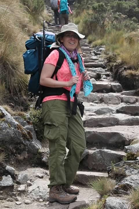
After about an hour of hiking we came to our first rest stop, known as Tres Piedres (Three Stones). There are squat toilets but no other amenities at this site.

At the rest stop, I caught sight of a beautiful bird eating berries from a nearby bush. I borrowed Rachel’s superzoom to snap a few photos which proved useful in later identifying it as a scarlet-bellied mountain tanager. As its name implies, this species is found only at high altitude, its range following the Andes.

Leaving the rest area, we hiked another 30 minutes uphill to reach what I consider the most fascinating section of the day’s hike, the cloud forest. Up until then, the trail from Wayllabamba had been bordered by bushes and some not too dense sections of forest.


It wasn’t foggy on this particular day, but the cloud forest was still lush. Some trees that looked like they were entirely covered in green moss. Here and there, beautiful flowers including orchids grew in breaks in the canopy.


For a short section a stream, identified by Google Maps as Río Llullucha (Quechua name unknown) flowed alongside the trail with mini waterfalls in the steep sections. This stream was a tributary of the Kusichaka that we’d seen the previous day.


Around 11 am we arrived at Llulluchapampa, a campsite at an elevation of 3,680 m (12,074′). Located at the treeline, the site was exposed and windy. We stopped for a snack here; it was too early for lunch but it appeared to be the last suitable cooking site before the campsite. Around noon, we started the most grueling stretch of the entire trek, the last 535 vertical meters (1,755 ft) to the high point of the Inca Trail, Warmi Wañusqa (Dead Woman Pass).


The ascent up the valley was brutal. I found myself stopping to rest every five or ten minutes, sitting with my backpack on the walls that sometimes ran parallel to the trail. Up until this point, I hadn’t felt the altitude on the Inca Trail the same way I had during our acclimation period in Bolivia. At Lake Titicaca, which was at slightly lower elevation than we were at now, we’d still had shortness of breath upon exertion even with five or six days at altitude. But now the altitude was affecting me again and I was winded. At points on the ascent it seemed like I couldn’t get more than a few steps without stopping to rest.
Although she’d been behind me most of the hike until now, Rachel actually caught up to me. Slow and steady, she’d say in explaining her pace. At this point, though, I was having difficulty staying steady even when I was hiking slowly. Generally, Rachel is much slower than me when hiking uphill and faster when hiking downhill. This fundamental difference in pace meant that, as unromantic as it sounds, we spent a lot of Day One and the first half of Day Two hiking separately. Ironically, the usual hiking patterns inverted during the steepest parts of the Inca Trail: Rachel hiked the steepest uphill sections faster than me, while I could descend the irregular stairs faster than she could. At this point, Rachel stuck with me to encourage me.

According to my reference books, the name Dead Woman Pass probably was based on the shape of the landscape, interpreted as resembling a woman laying dead, rather than being named after an actual woman who died at the pass. (Given the difficulty of the terrain, though, it is entirely possible!)

After the toughest two hours hiking of my life, we finally arrived at the pass at 2 pm. It was windy and barren terrain topping out at an amazing 4,215 m (13,829 ft) of elevation. We got our first look at the mountains on the far side of the pass. Yaneth said the section of the Inca Trail visible far below was what we would be tackling the next day.


We were the last of the group to arrive and a handful of the fastest hikers had already started their descent to the campsite at Pacamayo. Around 2:15 pm we started down as well. Although requiring far less exertion than the climb up, the irregular steps made the descent surprisingly difficult. At times I found to difficult to just put one foot in front of the other rather than stepping down and bringing the other foot to the same step (a much slower process). It was scenic, but the trail just seemed endless.


In all, we lost half the elevation we’d gained that day climbing to the pass. As we approached camp, a waterfall was visible on the mountain above. Yaneth said it was more spectacular when it was closer to the wet season. We arrived at camp around 4 pm.

Pacamayo was a decent sized site located next to a stream. The tents were set up on a series of terraces. Soon after we arrived, the group had a late lunch. There wasn’t much socializing in camp this evening; most of us retired to our tents to rest between lunch and dinner. A brief rain storm hit during the evening. I was a reminder how lucky we were that the weather while actually hiking was absolutely perfect. Once again, Percy advised us not to leave anything outside the tent overnight, especially shoes. He said foxes like to steal them.
Date: Thursday, August 20, 2015
Distance: 11 km (6.8 mi)
Steps recorded for the day: 20,669
Duration: About 8 hours (about 6.5 hours of that hiking)
Series on the Inca Trail (Camino Inka)
Planning a Trip to Bolivia and Peru (background)
Introduction (Cusco to Ollantaytambo by Bus)
Day One (Piscacucho to Wayllabamba)
12 km (7.5 mi) distance, +300 m (984 ft) elevation
Day Two (Wayllabamba to Pacamayo)
11 km (6.8 mi) distance, +1,200 m (3,937 ft)/-600 m (1,969 ft) elevation
Day Three (Part I, Pacamayo to Qunchamarka AND Part II, Chaquicocha to Wiñay Wayna)
15 km (9.3 mi) distance, +350 m (1,148 ft)/-1,300 m (4,265 ft) elevation
Day Four (Wiñay Wayna to Machu Picchu)
5 km (3.1 mi) distance, +40 m (131 ft)/-265 m (869 ft) elevation
Inca Trail’s End: Machu Picchu

Looks like an awesome trail with much to explore
LikeLike
So lovely to read about your experiences with traveling to (and through) one of my must sees travel destinations!
LikeLike