
Sixth in a series about the Inca Trail
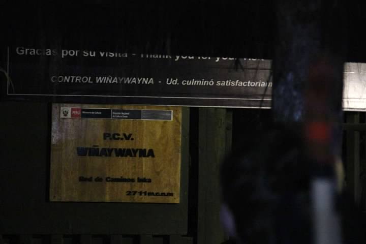
This was it, the home stretch. Our guides, Percy and Yaneth, wanted us to be lined up in front of the Wiñay Wayna checkpoint by 4:30 am on the final day of our trek. The checkpoint didn’t open until 5:30 am, but the earlier we arrived, they said, the better our chances of being at the Sun Gate for sunrise over Machu Picchu.
I don’t think I slept past 3 am. I’d love to say it was because of the anticipation, but we were next to a tent where the porters were talking loudly throughout the night. In addition, it was difficult to get comfortable. The sleeping bags only unzipped a little around the head. During the first and second nights we were high in the mountains and the sleeping bags were nice and warm. The third night, however, it was too hot in the sleeping bag and eventually, too warm outside it as well.
On Rachel’s advice, I put a few layers of Molefoam in a circular pattern around my blisters, leaving the blisters themselves aired out. I switched back to my trusty Merrell Chameleon hiking shoes and the blisters didn’t bother me too much. One of my knees was hurting from “The Gringo Killer” the afternoon prior, but not too badly. Rachel, on the other hand, was in severe pain in both knees. Breakfast was light, but we received a bag with snacks for later on (though they’d have to be eaten outside Machu Picchu).
We broke camp in the dark and made our way down to the trail in front of the checkpoint. We sat against our packs by the trailside and waited for the checkpoint to open. The stars were spectacular. I was surprised to see my favorite constellation, Orion, in the Southern Hemisphere. From my perspective it was flipped upside down relative to what I was used to.
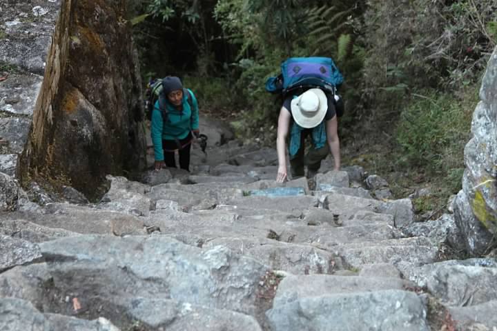
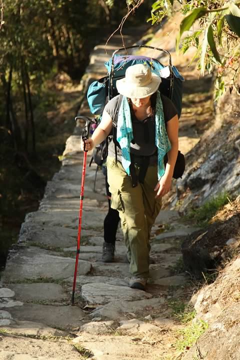
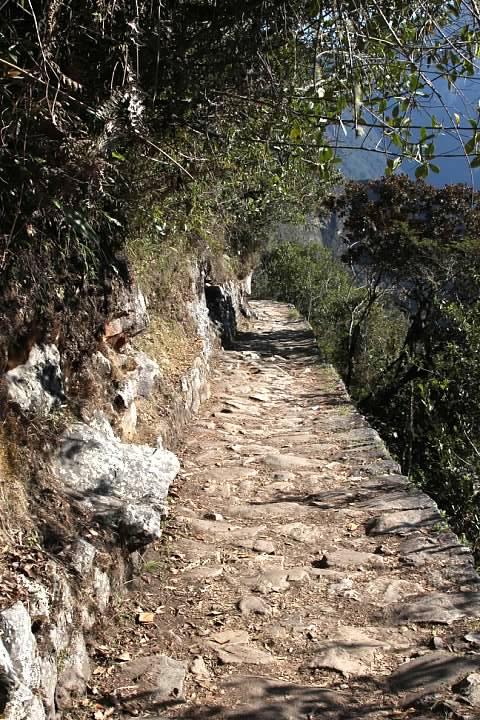
We were one of the first groups through the checkpoint, passing through around 5:40 am. The trail was similar to the third day with rolling “flats” and a sheer drop-off into the forest on the right hand side of the trail. Within a couple minutes of passing through the checkpoint, Rachel yelled to me to wait for her. She was close to tears from the knee pain. One group and then another passed us.
The long days on the trail had taken their toll on mind as well as body. My first reaction wasn’t supportive but rather disappointment, embarrassment, maybe even resentment. Disappointment that we would probably not make it to the Sun Gate by sunrise. Embarrassment that for a third day in a row, Rachel and I would be dead last in our group. Resentment that Rachel was the one slowing us down (even though I’d been the slow one on Day Two).
It seems to me most people who can afford a honeymoon go places with amazing luxury. I would have just as soon honeymooned in Bora Bora rather than rough it on the Inca Trail! That luxury, perhaps, postpones the challenges that every couple eventually faces. The day after we finished the Inca Trail, I looked back with shame on my thoughts at that moment of resentment. While the relationship was strong, I realized I had to work on improving myself.
Regardless of my initial selfish impulses, I turned around. I hugged Rachel to comfort her for a minute or two. Yaneth came up behind us and offered Rachel encouragement, though she really just wanted a private moment to collect herself. Rachel, despite her excruciating pain, sucked it up and we continued hiking. (Can you tell that Rachel edited this paragraph? Love you, dear!)

As I walked and Rachel hobbled, the sky to the east caught fire with a spectacular sunrise beyond the mountain peaks. I took few pictures, not wanting to do anything to slow us down. There was a sharp drop off to the right of the trail down a steep mountainside with the Sacred River, the Willkamayu (Urubamba River) running below. This was the very river (though by a different name) that we’d crossed on Day One.
As we hiked, a large bird landed in a tree nearby. We asked Yaneth what it was called. After a hesitation searching for the correct English word, she answered that it was a turkey. I later identified it as an Andean guan thanks to a field guide, Birds of Peru. The book describes guans as “large, long-tailed, and long-necked birds resembling pheasants or turkeys” with a diet consisting mainly of fruit.
Rachel gave me a scare at one point climbing some stairs. She tottered and fell forward, precariously close to the edge of the trail. She said when she felt herself losing her balance, she threw herself down to prevent just that from happening.
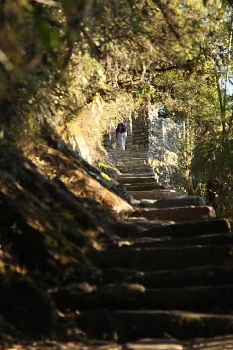
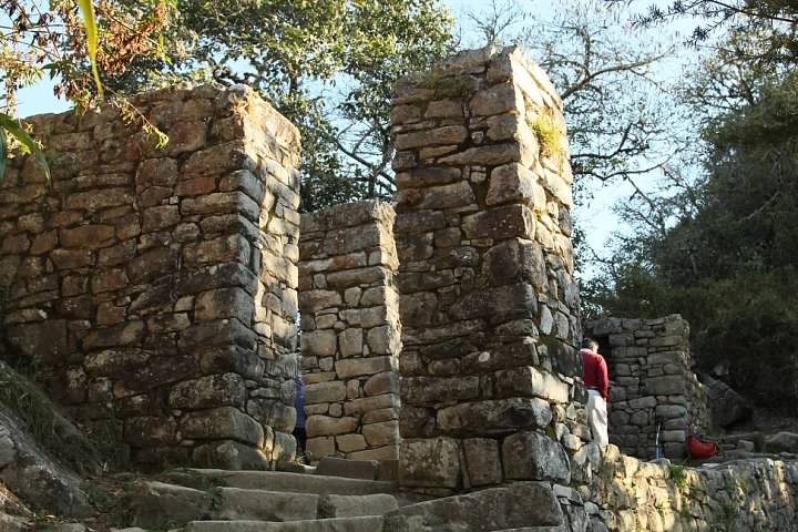
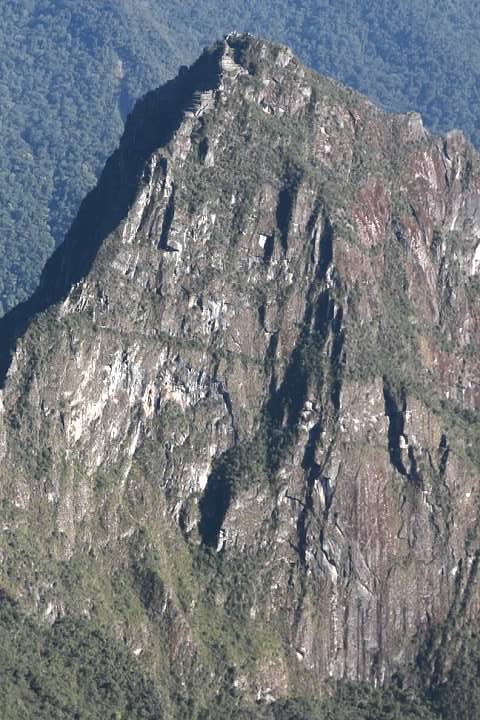
There was one challenge left. It was another staircase that was so steep, it had to be climbed like a ladder. It led to what Stewart calls a watchtower.
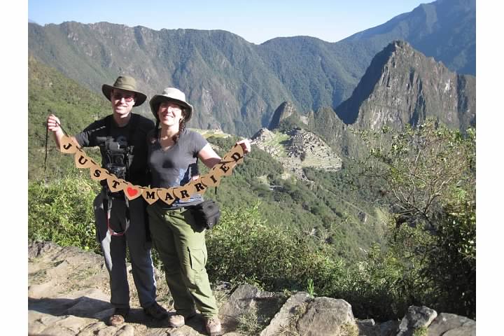
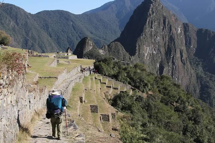
We were so close to the end of the hike. Within minutes, it was just one more “flight” of stairs between us and Intipunku, the Sun Gate. I hiked up ahead, but I didn’t go inside. I wanted Rachel and me to get our first look at Machu Picchu together. It was now 7:15 am.
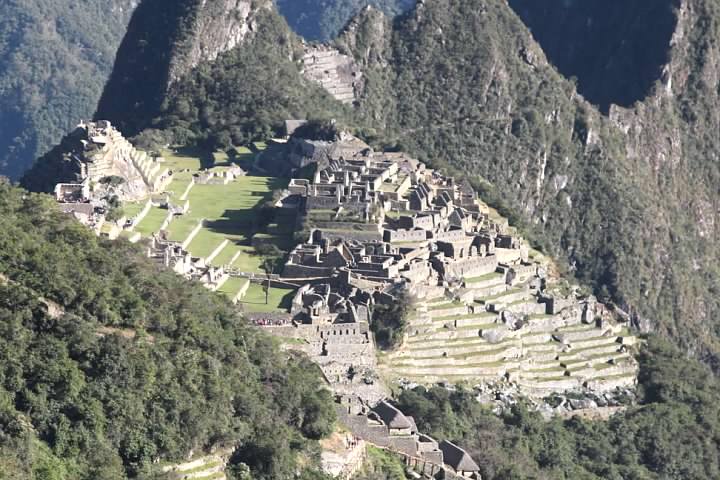
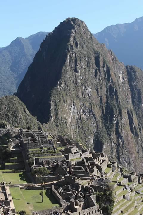
Then we were there, alone despite our guide and the throngs of hikers, sharing that moment of exhilaration when the journey and sense of accomplishment becomes real. This is what we saw:
Intipunku was at an altitude of 2,720 m (8,924 ft). There was going to be no more uphill between here and Machu Picchu, but the downhill had to be taken gingerly with Rachel’s knees.
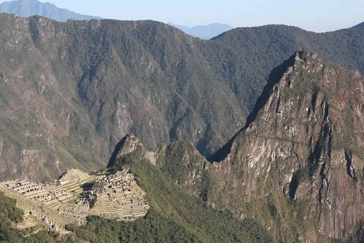
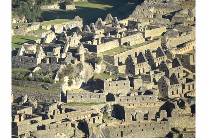
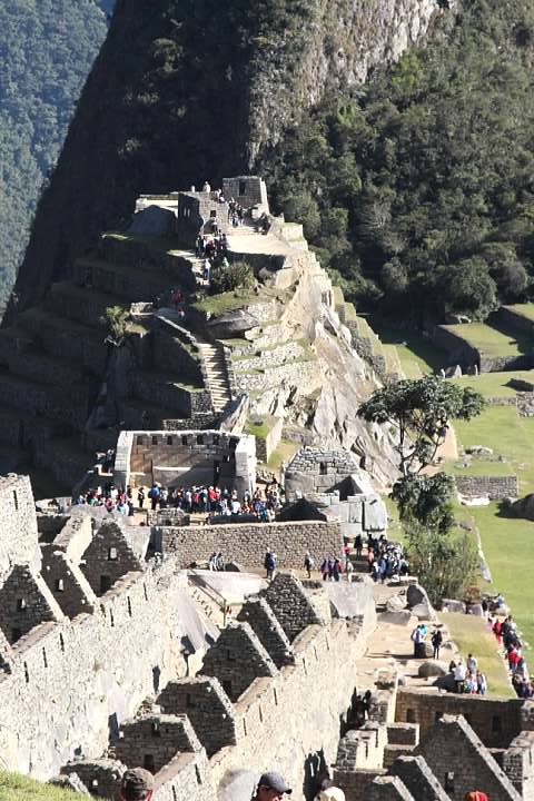
The trail headed towards some ruins on the outskirts of Machu Picchu. I’ve been unable to determine what its name is, but it’s built around what I assume is a sacred rock (Percy said these are common among Incan ruins).


Yaneth stopped to scold some young women who were carelessly climbing on the ruins. Machu Picchu survived half a millennium of earthquakes, heavy rains, and jungle overgrowth in remarkably good condition, but its own popularity may now be its greatest threat.
By this point, the trail was filled with day trippers headed the other direction. We were still quite high above the city, though the trail was in good condition with a gentle slope.
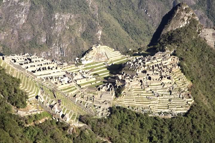
The descent from the Sun Gate only took an hour, but it seemed like it lasted forever. My knee and blisters were forgotten as we got closer and closer. And then we were there, walking the path among the terraces of the agricultural sector.
There are places in the world whose reputations create impossible expectations and a visit is sure to cause disappointment. Machu Picchu is not one of those places. It is every bit as incredible as we hoped for, an engineering marvel in the most picturesque of locations.
Looking back, I feel a pride at having accomplished the hike while still remembering how humbled I was by the experience. The low daily mileage had lulled us into a false sense of security and led us to overestimate of our physical condition. It turned out to be a very tough hike.
Either way, the hard part was over. Large backpacks are not permitted inside Machu Picchu, so we had to exit at the main entrance (where the day trippers enter) and pay a small fee to check them at the luggage room. I wasn’t particularly sad to part with the weight for a few hours. We were reunited here with the rest of the group, who charitably said they hadn’t been waiting for us long. After scarfing down a snack (food is also prohibited inside), we lined up to head back in to explore the site.
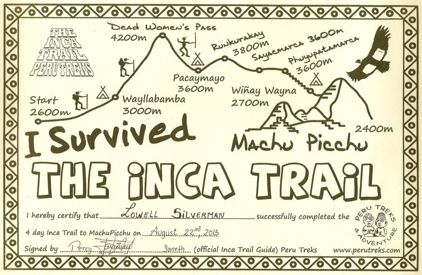
Date: Saturday, August 22, 2015
Distance: 5 km (3.1 mi)
Duration: About 2.5 hours
Series on the Inca Trail (Camino Inka)
Planning a Trip to Bolivia and Peru (background)
Introduction (Cusco to Ollantaytambo by Bus)
Day One (Piscacucho to Wayllabamba)
12 km (7.5 mi) distance, +300 m (984 ft) elevation
Day Two (Wayllabamba to Pacamayo)
11 km (6.8 mi) distance, +1,200 m (3,937 ft)/-600 m (1,969 ft) elevation
Day Three (Part I, Pacamayo to Qunchamarka AND Part II, Chaquicocha to Wiñay Wayna)
15 km (9.3 mi) distance, +350 m (1,148 ft)/-1,300 m (4,265 ft) elevation
Day Four (Wiñay Wayna to Machu Picchu)
5 km (3.1 mi) distance, +40 m (131 ft)/-265 m (869 ft) elevation
Inca Trail’s End: Machu Picchu
