Fourth in a series about the Inca Trail
Day Three of the Inca Trail was by far the longest of four days of hiking, covering a distance of 15 km (9.3 mi). Although Day Two has the reputation for being the most grueling day (primarily due to ascending Dead Woman Pass), Day Three is almost as challenging. The route ascends to—and descends from—another two mountain passes. Unlike the Day Two hike, Day Three is rich in archaeological sites. In addition, according to our guide Percy, the Inca Trail here is about 90% original (unlike the first two days where the trail has undergone significant restoration).
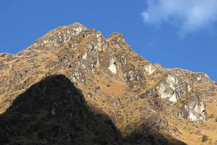
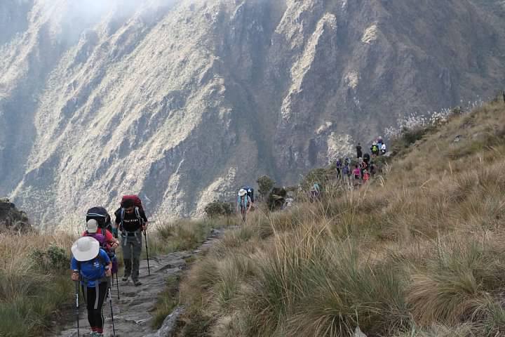
Despite a brief rainstorm the previous evening in camp, it was perfect hiking weather: warm (maybe 18 °C/65 °F) and sunny. We got on the trail later than the guides planned. After passing through the next checkpoint around 7 am, we began a steep ascent up the mountain Runkuraqay. In one section, the Inca stairs were so steep they had to be climbed like a ladder!
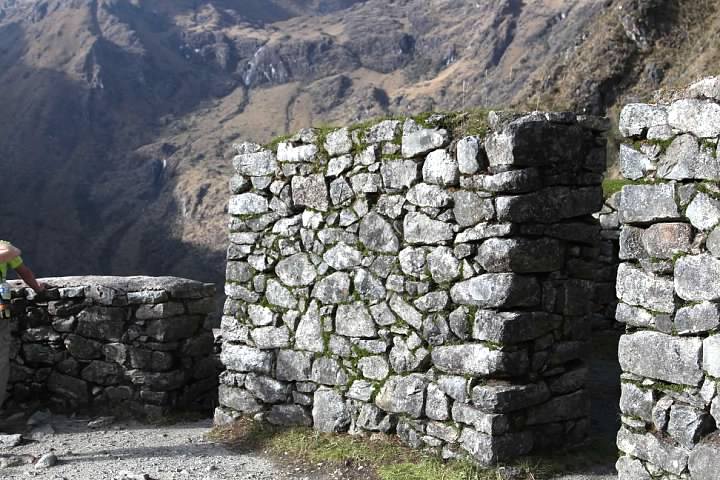
At around 7:45 am, midway up the mountain, we stopped at some ruins at elevation about 3,780 m (12,402 ft). The ruins share their name with the mountain they sit on, Runkuraqay. Like all ruins on the Inca Trail, archaeologists can only speculate as to its purpose. The Inca kept no written records. My references (and Percy) agree that it was most likely a tampu (tambo), an inn or rest stop for Incan travelers and messengers. Percy said they’re typically found every 5 to 7 km along the trail.
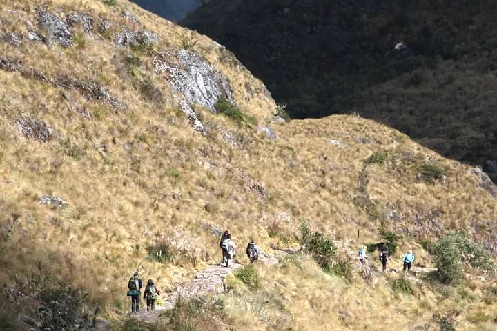
The trail continued uphill toward Runkuraqay Pass, the second of three passes on the Inca Trail. It was a challenging climb, although not as bad as the previous day’s ascent of Dead Woman Pass.
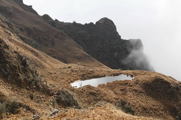
I was surprised to see a high mountain pond close to the pass, since we hadn’t seen any bodies of standing water yet along the trail. We had a lengthy stop at Runkuraqay Pass (elevation about 3,985 m/13,074 ft) starting around 9 am.
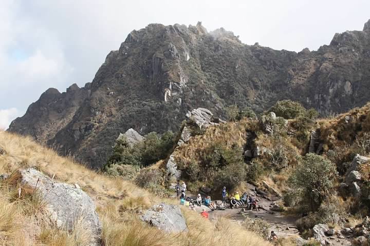
After letting everyone rest for a few minutes, Percy held a ceremony near a large rock at the pass. He discussed the beliefs and customs of the peoples living in the Andes and left coca leaves as an offering.
Percy said those hiking the Inca Trail were chosen to do so. Our lives would change, he said, from the experience of having traveled it. Despite being popularly known as the Inca Trail, we were hiking was a Inca trail, one of many. The Inca Trail we were hiking was certainly not the shortest, nor the easiest, nor the most practical route to Machu Picchu. Rather, it was one that brought travelers into communion with the mountains, streams, and forests that the Inca held sacred.
During the ceremony, Percy told a story. All the animals were fleeing a wildfire. A deer (I think it was) saw a hummingbird flying towards the fire instead of away, and asked the bird why he was being so foolish.
“At least I’m doing my part,” replied the hummingbird. The hummingbird was going down to the water, filling its bill, and then dropping the water on the fire. (I guess that makes the hummingbird the original aerial firefighting tanker!)
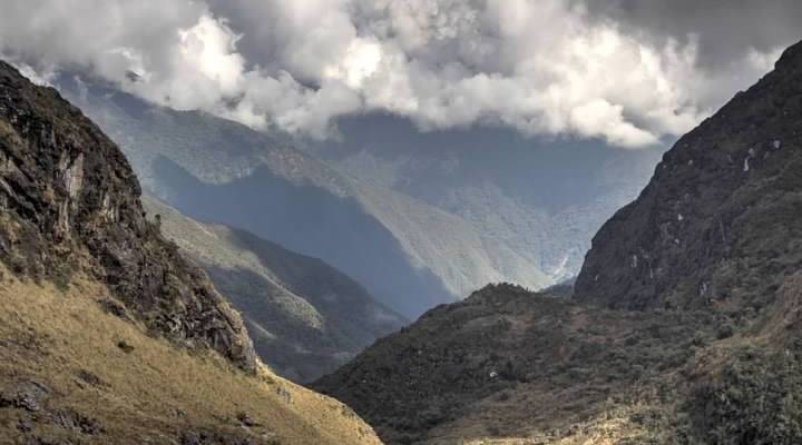
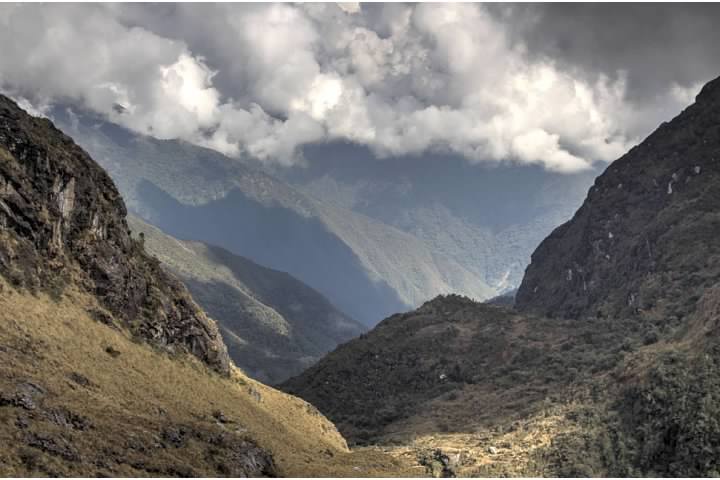
Around 9:30 am, after the ceremony, we put our packs back on and began descending the trail on the far side of the pass. In the distance, the mountains were densely forested (which Percy said was the beginning of the Amazon rainforest).
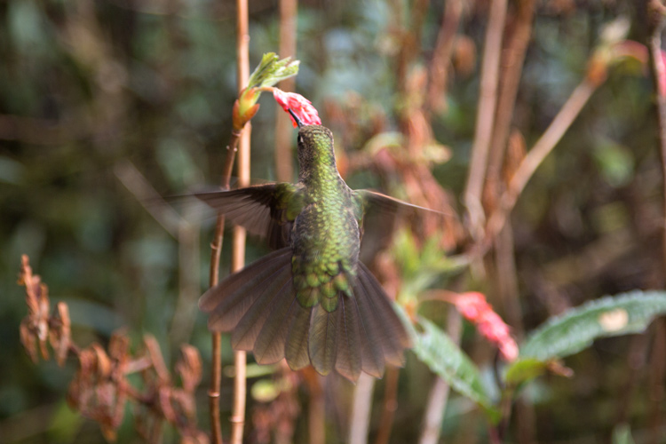
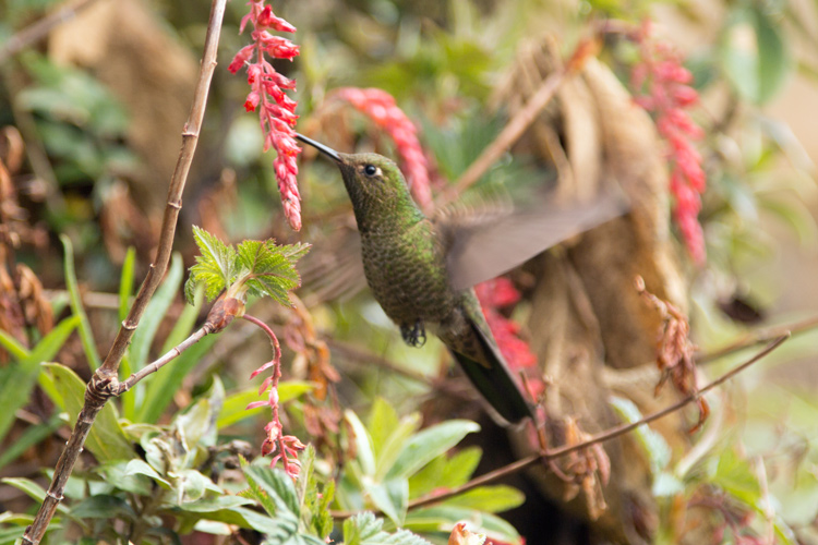
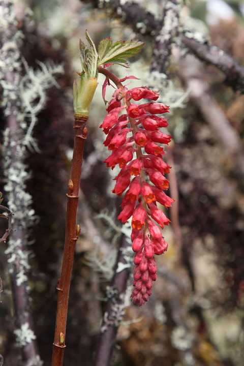
I was surprised when a small hummingbird began feeding on flowers along the trail not a meter in front of me. It was incredible being so close to this fearless bird. It was an especially interesting sighting given the story we’d just heard. Although not every photo I took of it was sharp, I was able to almost fill the frame with a small subject using only a 105 mm lens.
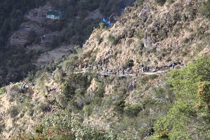
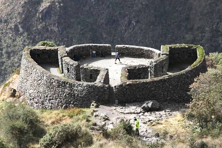
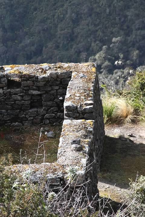
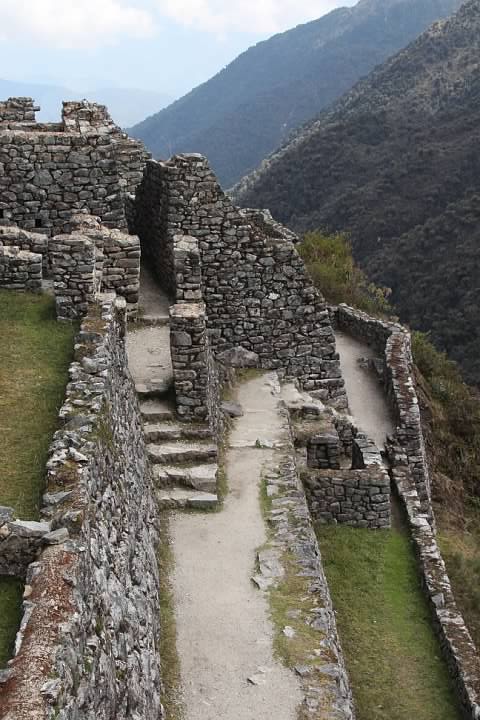
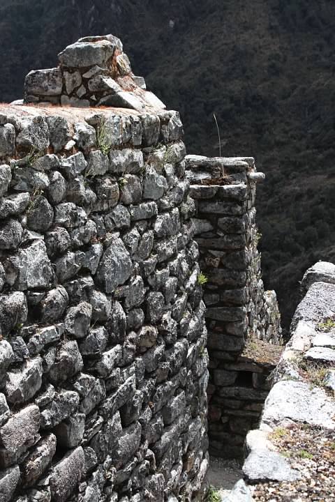
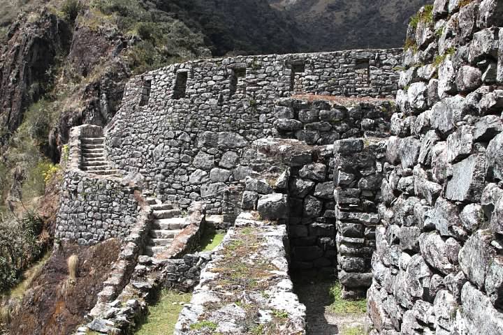
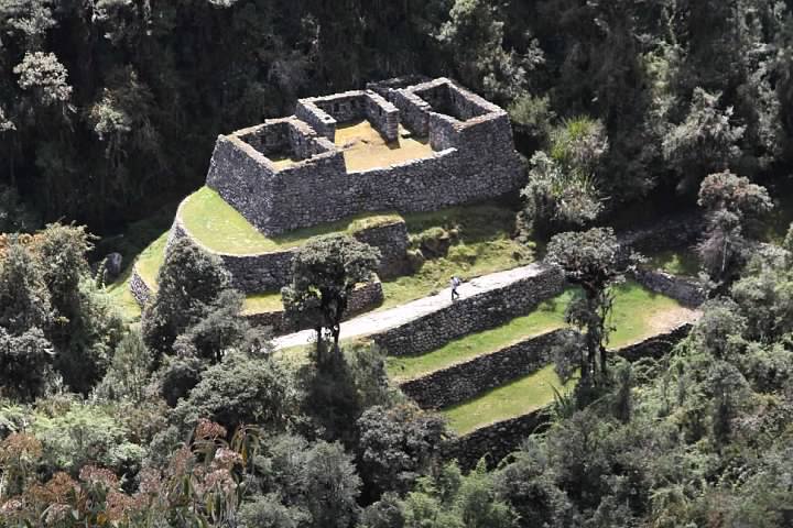
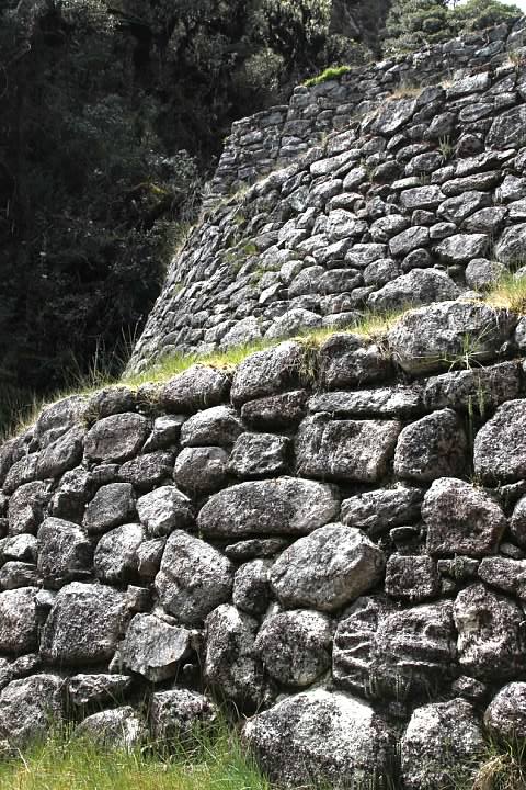
We descended rather steeply from the pass. After some hiking, the impressive ruins of Sayaqmarka (Sayac Marca, elevation about 3,645 m/11,959 ft) came into view around a curve around 10:30 am.
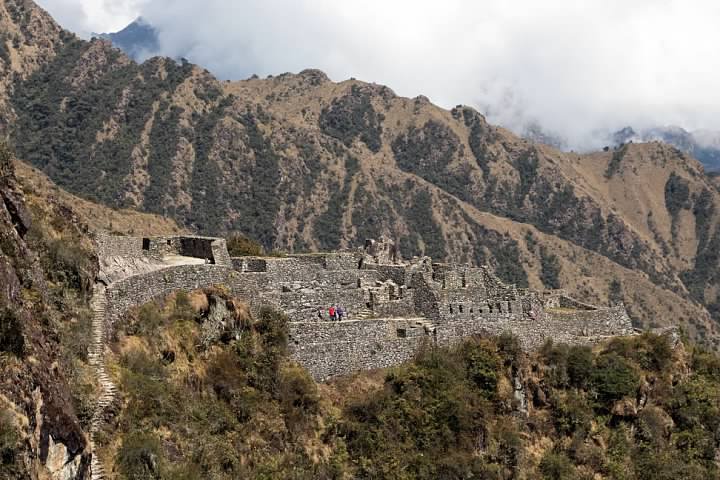
Like every ruin on the Inca Trail (including Machu Picchu) the Incan name for Sayaqmarka is unknown. The modern Quechua name means “inaccessible town” in reference to its remarkably defensible location. The only way into the ruins is by way of a steep climb up a narrow staircase. We dropped our packs at the base of the steps and headed up inside. Sayaqmarka was rediscovered by Hiram Bingham, who also explored many ruins in the area including Machu Picchu.
Sayaqmarka is something of a mystery. Alexander Stewart explains in his book The Inca Trail:
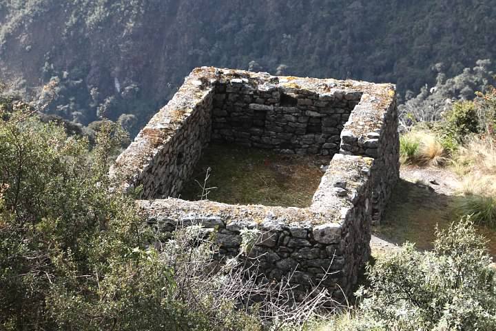
Bingham believed that the site was a fortress and an outpost for Machu Picchu. [Dr. Paul] Fejos disagreed saying that it wasn’t impressive enough to be a fortress. Neither is the stone work of sufficiently high quality for the site to be a religious centre although there are ceremonial water channels at the base of the outcrop. Nor are there enough terraces or agricultural land in the vicinity for it to have been a farming outpost. With the compact Concha Marca ruins just below, it is also unlikely to have simply been a tambo, meaning that no-one is actually sure what these superb ruins were originally used for.
The ruins overlooked the site Stewart mentioned, Qunchamarka (Concha Marca), presumed to be tampu (trailside inn).
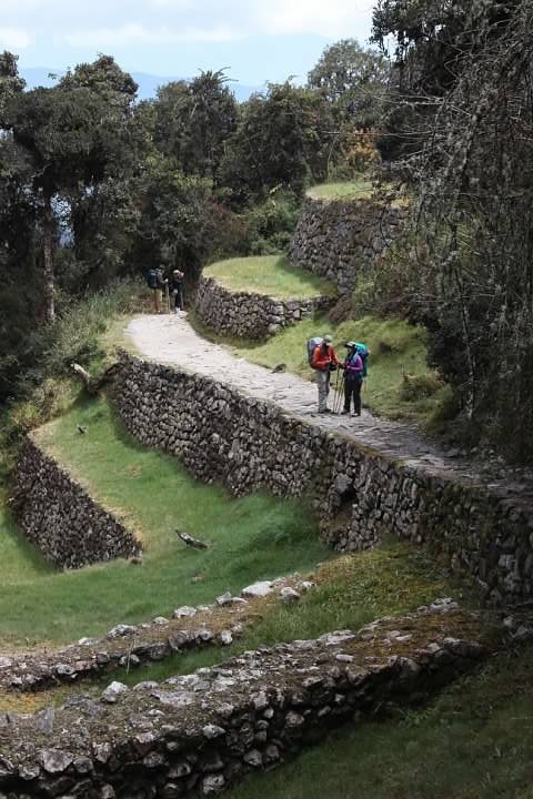
We headed back down the stairs to our packs. I could feel a rubbing sensation in both big toes and stopped to apply some Molefoam. Although I’d worn my trusty Merrell Chameleon hiking shoes on the first day of hiking, with all the ups and downs on Days Two and Three I figured it would be wise to switch to some hiking boots with more ankle support. My Wolverines boots, however, did not feel as comfortable as the Merrells and I felt some hot spots at the end of Day Two. It was probably a mistake to wear them two days in a row.
We picked up the Inca Trail again around 11:30 am, hiking another 20 minutes heading downhill past Qunchamarka to a campsite, Chaquicocha, where a tent was set up for lunch.
Series on the Inca Trail (Camino Inka)
Planning a Trip to Bolivia and Peru (background)
Introduction (Cusco to Ollantaytambo by Bus)
Day One (Piscacucho to Wayllabamba)
12 km (7.5 miles) distance, +300 m (984′) elevation
Day Two (Wayllabamba to Pacamayo)
11 km (6.8 miles) distance, +1,200 m (3,937′)/-600 m (1,969′) elevation
Day Three (Part I, Pacamayo to Qunchamarka AND Part II, Chaquicocha to Wiñay Wayna)
15 km (9.3 miles) distance, +350 m (1,148′)/-1,300 m (4,265′) elevation
Day Four (Wiñay Wayna to Machu Picchu)
5 km (3.1 miles) distance, +40 m (131′)/-265 m (869′) elevation
Inca Trail’s End: Machu Picchu
