
Fifth in a series about the Inca Trail
We had lunch at Chaquicocha, a campsite about 20 minutes’ hike from the last ruins we’d passed, Qunchamarka. Our cook, Milton, outdid himself with this meal, which was by far the best of the hike.
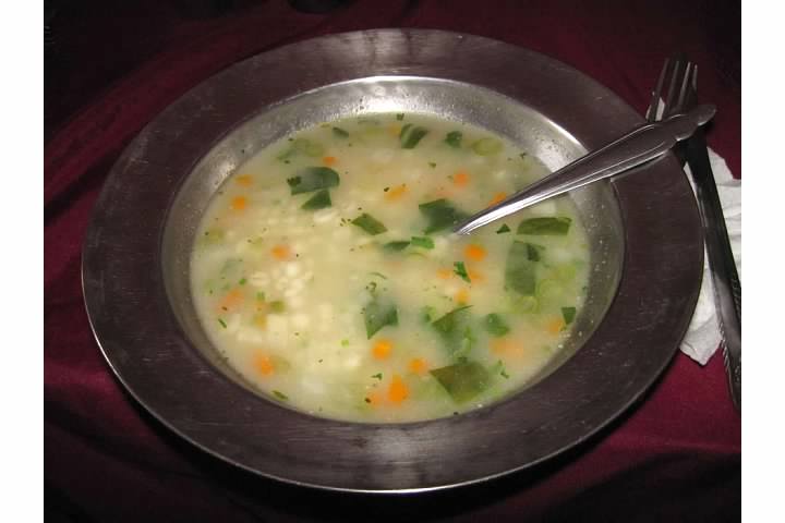
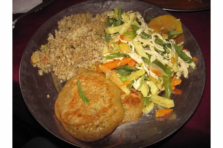
Like every other lunch and dinner, the first course was soup. Whether vegetable or potato, the soup always hit the spot after a long day on the trail. The main course was shredded chicken and vegetables, quinoa, and what I think was a potato pancake. (I’m afraid I kept very poor notes on the trail.)
Potatoes were first cultivated in present day Peru and Bolivia and were common in our meals on the trail. On the other hand, we were usually served rice instead of quinoa. Quinoa, an Andean pseudocereal, has long been a staple in local diets but in recent years has also experienced growing attention and popularity in developed countries.
Aside from our guides, Percy and Yaneth, we’d had limited interaction with the Peru Treks support staff (primarily made up of porters). We were supposed to be introduced during lunch on Day Three. However, when the mealtime came, our guides advised that this wouldn’t be possible. We’d gotten a late start in the morning and were now running almost an hour behind schedule. This was a major problem on the longest day of the hike. Before falling behind, our scheduled arrival in camp for that night was 4:30-5:00 pm. The delay meant we’d be hard-pressed to make it to camp before sundown at 5:45 pm.
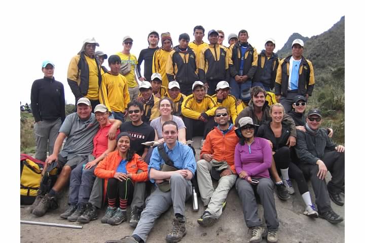
Although the introductions didn’t take place, our guides did arrange everyone for a group picture with all the hikers and porters. We geared up and began hiking towards the third and final mountain pass around 1 pm.
Our guides described the terrain here as “Andean Flats.” The term is more than a little ironic, since the trail could not be described as flat by any stretch of the imagination. In fact, the trail was constantly up or down, with no more than a few meters at a time being level. The route was “flat” only in that the ups and downs largely cancelled out one another. Indeed, the third pass was only about 115 m (377 ft) higher than or lunch spot, Chaquicocha.
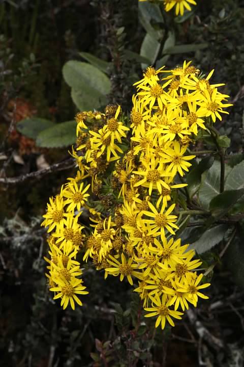
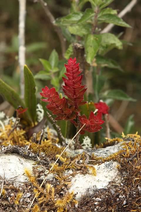
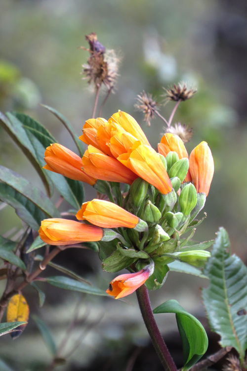
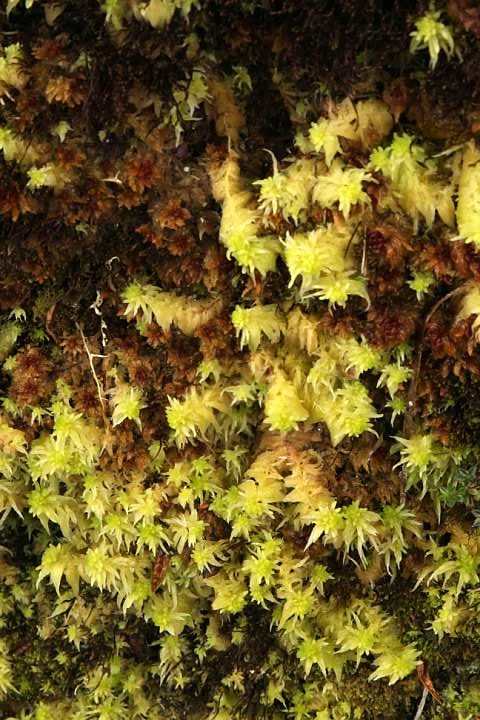
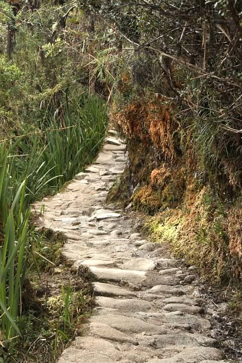
The terrain during this section was quite lush with dense, tropical looking foliage and plenty of flowers. Percy had said this was the edge of the Amazon rainforest. In places, water seemed to seep from rock rocks, nourishing strange looking plants or moss.
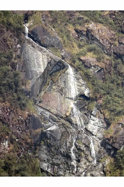
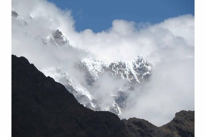
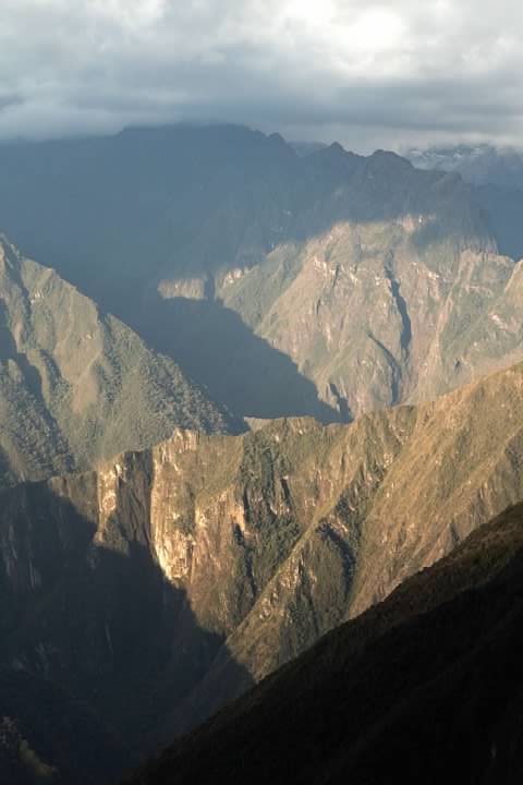
To our left, the trail dropped off steeply. The valley was densely forested, and there was a pretty waterfall on the far side. In the distance, the snowcapped peak of Sallqantay (Salcantay) was visible shrouded by clouds.
At one point, the trail entered a tunnel that the Inca somehow seem to have cut through solid rock.
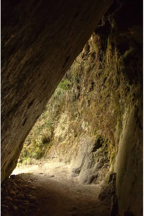
- Inca tunnel in HDR


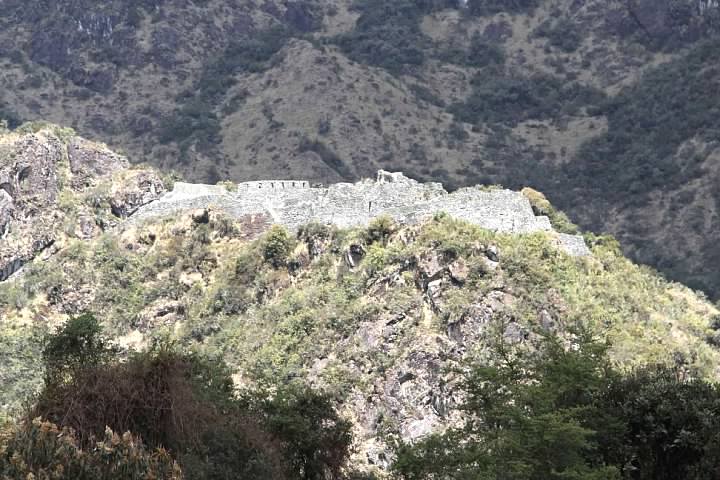
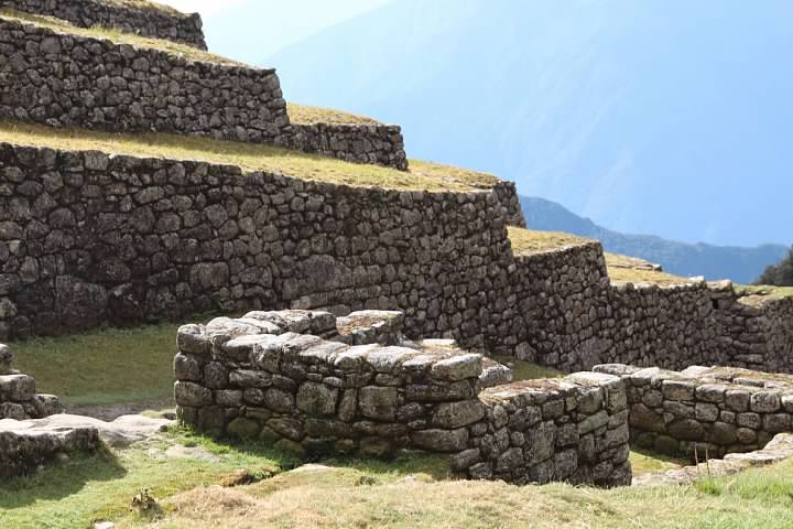
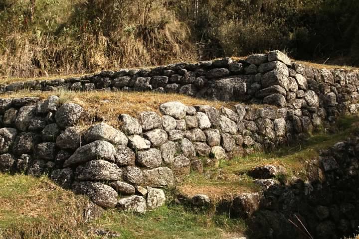
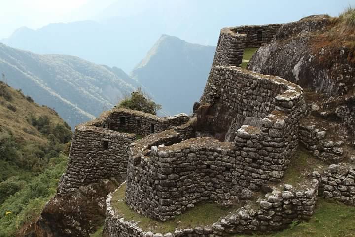
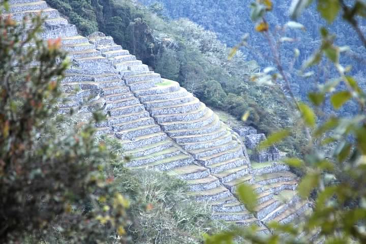
We arrived at the third pass (elevation about 3,690 m or 12,106 ft) around 2:30 pm. The pass contains sweeping views of several ranges of mountains, the town of Aguas Calientes (Machupicchu city), and the back side of Machu Picchu Mountain. Machu Picchu (the archaeological site) is actually named after the mountain it was built upon, since the original Inca name is unknown. In the distance, the tall terraces of Wiñay Wayna were visible. These ruins were located near our campsite, but seemed quite far away.
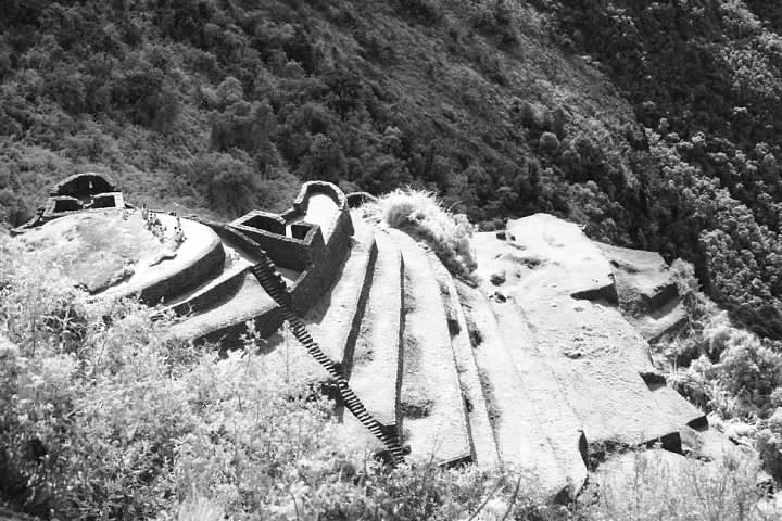
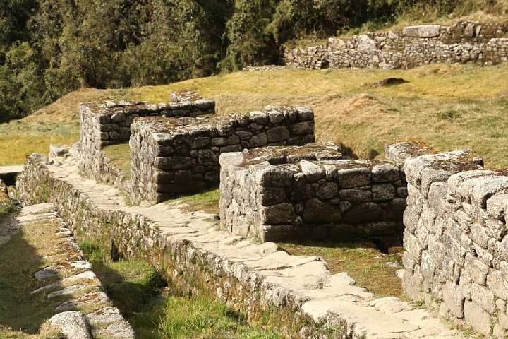
Just below the pass is Puyupatamarca (Phuyu Pata Marca, translating as “city above the clouds” or “cloud level town”), a beautiful ruin with multiple terraces and staircases. As with all the sites along the Inca Trail, archaeologists can only speculate as to their purpose. One theory is that the ruin had a religious purpose for the Incans. Alexander Stewart describes the site this way in his book The Inca Trail:
“To one side are six ‘Inca baths’ (five ceremonial baths and one principal one) that were probably not actually used to wash in, but are more likely to have been used in conjunction with the ritual worship of water.”
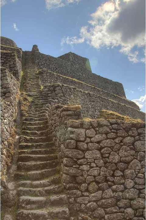
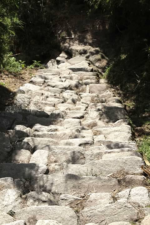
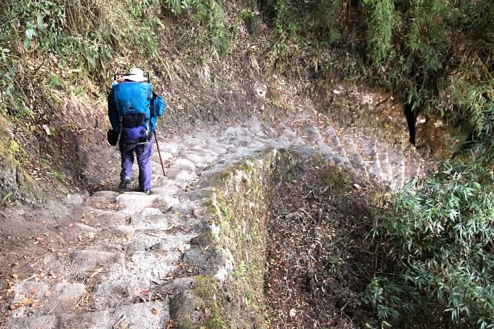
Yaneth warned us at the pass that we were about to begin what previous groups of trekkers had nicknamed “The Gringo Killer”. I want to say they told us it was about 2,500 steps (Wikipedia says 1,500) carved out of the mountain. Either way, it was a descent of a vertical kilometer (about 1,012 m or 3,320 ft according to my GPS data) from the third pass to our campsite.
Although descending seems like it would be a lot easier than hiking uphill, it was actually quite torturous. The steps are very irregular in shape. I found in many cases it was impossible to step down to the next step (as I would a normal staircase) without first bringing the trailing foot alongside the front foot. Not only did that make it slow going, but it was very hard on our knees. Rachel still jokes that, “If the Incas had built the trail up Mt. Whitney, the 99 Switchbacks would have been 30 switchbacks consisting of stone stairs going straight up the mountain!” She may also have called the Incas “sadists” once or twice…I wasn’t overly sympathetic, considering that it was her idea of a honeymoon hiking the Inca Trail in the first place instead of, say, lounging on a beach in Tahiti!
Interestingly, Stewart writes that the Incan stairs were rediscovered only in the 1980s; before that time, Inca Trail trekkers took an alternate, roundabout route to Wiñay Wayna. The older route is no longer maintained or passible.

Although Rachel is usually faster than me hiking downhill, the stairs were a different game. I had to wait for her several times and we took a few breaks. At one point she even began cracking up. The reason was a sort of optical illusion in which a couple ahead of us on the trail were quite close but looked like they were standing about 10 vertical meters below us, with no apparent way of getting down (it was because the trail curved to the right and then back in front of us).
Making the scene more farcical was the fact that a Peruvian man was coming up the stairs and had just stepped to the side to let us pass. Rachel was paralyzed with laughter, so this man was just standing there looking uncomfortable. He shot me a sidelong glance as if to ask, “What is wrong with this crazy person?”
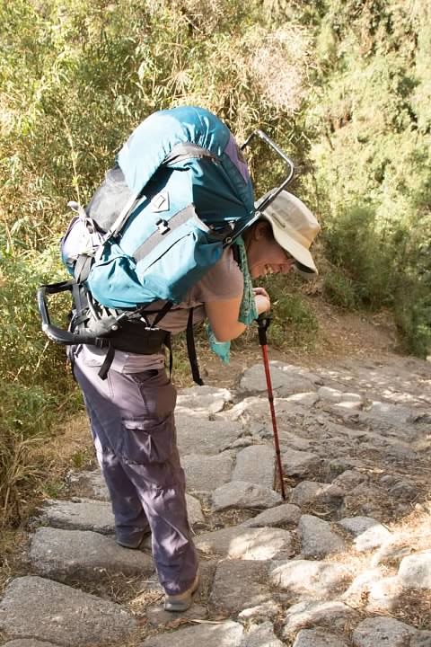
At the pass, Yaneth told us that if we had time, we could walk through the Incan ruins at Wiñay Wayna (Huiñay Huayna, translating as “forever young” and actually named after an orchid found at the site). If not, we’d have to take a shortcut to the campsite, also known as Wiñay Wayna. It was clear that we would have no choice but to take the shortcut, but I became increasingly worried that we wouldn’t make it before dark (which, of course, we didn’t). Even with the urgency, it was very difficult to increase our pace given the irregular steps. (I was not taking many photographs at this point, and would only pause a few seconds when I did.)
Yaneth was waiting for us at the fork in the trail when we arrived around 5:30 pm, 15 minutes before sunset. We were clearly the last ones from the group. Rachel’s knees were in really bad shape by this point. I could feel that the Molefoam on my feet had slipped, but there was no time to reapply it.
Yaneth told us the shortcut would take 20-30 minutes, but it actually took closer to 45. The shortcut was a seemingly endless series of switchbacks. The soil was soft, which was more comfortable to walk on than the Incan stone, but it was actually rather slippery in places. I almost fell a few times. Rachel actually did slip and fell on her butt, damaging her hiking pole in the process. (Looking on the bright side, she says no trek is complete for her without a fall!) It was quite dark by the time we approached the campsite.
Maybe 10 or 15 minutes outside of camp, two Peru Treks porters came up the trail. “Mochilla?” one asked me. He was offering to take my backpack! I was embarrassed enough about us being dead last in the group. I had no intention of surrendering my backpack (and my dignity) for the last little bit of hiking that remained.
“No, gracias,” I replied. Rachel kept her backpack as well. Even when we came to the campground, there were still a few minutes of hiking to go, as various groups were camped on different levels, which appeared to be terraces. Our group was on a low level, no doubt a coveted spot due to its proximity to the checkpoint. We arrived at our campsite just before 6:15 pm. The hot spots I’d felt on my feet at Sayacmarca were now two huge blisters. Rachel was practically hobbling due to knee pain.
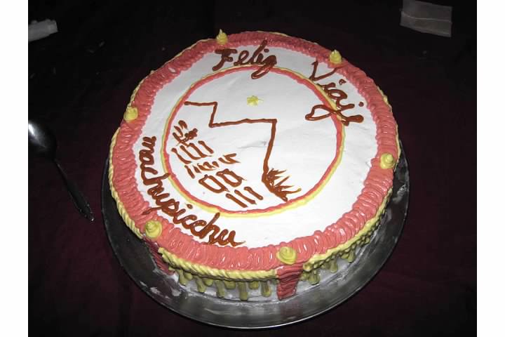
There was a surprise with dinner. Milton had somehow managed to bake a cake in camp! Percy said Milton went down to Aguas Calientes for the ingredients earlier. Milton had been cooking with cylinder of compressed gas to generate heat throughout the trek, but I have no idea what he used for an oven!
Percy taught us how to thank Milton and our porters as well as how to say goodbye in Quechua. Rachel and another hiker also delivered statements in Spanish thanking them for their help before we presented them with our tips. The hikers lined up and the porters came down the line, shaking our hands as we thanked them.
Date: Friday, August 21, 2015
Distance: 15 km (9.3 mi)
Steps recorded for the day: 32,297
Equipment: Kelty external frame backpack, Wolverine hiking boots, Eastern Mountain Sports trekking pole
Duration: About 11 hours (about 7-7.5 hours of that hiking)
Series on the Inca Trail (Camino Inka)
Planning a Trip to Bolivia and Peru (background)
Introduction (Cusco to Ollantaytambo by Bus)
Day One (Piscacucho to Wayllabamba)
12 km (7.5 mi) distance, +300 m (984 ft) elevation
Day Two (Wayllabamba to Pacamayo)
11 km (6.8 mi) distance, +1,200 m (3,937 ft)/-600 m (1,969 ft) elevation
Day Three (Part I, Pacamayo to Qunchamarka AND Part II, Chaquicocha to Wiñay Wayna)
15 km (9.3 mi) distance, +350 m (1,148 ft)/-1,300 m (4,265 ft) elevation
Day Four (Wiñay Wayna to Machu Picchu)
5 km (3.1 mi) distance, +40 m (131 ft)/-265 m (869 ft) elevation
Inca Trail’s End: Machu Picchu
